Emergency coastal flooding decision support system
Summary
Combining years of mapping data from past projects with high-resolution elevation data collected from an aircraft using lidar technology, Applied Geomatics Research Group's (AGRG) dedicated team of coastal mapping researchers have developed an online tool to help Atlantic Canadians prepare for coastal flooding from storms.
Challenge
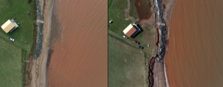
Coastal flooding and erosion in Atlantic Canada have always been a concern but never more so than now as climate change is impacting the region more frequently and intensely than ever before.
Outcomes
The online tool links predicted tide and storm surge, up to 10 days in advance of a storm, interactively with the flood map. The flood risk support system provides valuable information for surge predictions from storms and hurricanes as well as for people wanting to do long-term planning that need to consider sea-level rise in the next 50 to 100 years. The flood risk map was in high demand leading up to and following Hurricane Fiona and demonstrated the predictive models to be accurate.
Check out AGRG's Emergency coastal flooding decision support system.
Partners
- Environment and Climate Change Canada
- Department of Fisheries and Oceans
- GeoNOVA - Province of Nova Scotia
- Defense Research and Development Canada